| |||
|
Site Plan Renderings:
A 2d site plan rendering which had to encorporate single family residences, duplexes, multi-story / multi-family condos, large park spaces, dedicated natural zones, walking paths, a community center and water features. This project, located near Portland, OR, offered unique challenges of incorporating daily changes from the civil engineer, tree surveys which changed several times and contained over 1000 specific trees, constantly changing designs from two architectural firms, aerial photography from several disparigent sources and issues with the local jurisdiction over where the allowable building envelopes were. Additionally, with each change, square footage areas needed to be recalculated for impact zones, parking totals and coverage amounts. From all this over 10 drawings needed to be updated daily with all the changes so a single drawing base was used with the latest version of AutoCAD to create a quickly editable drawing. 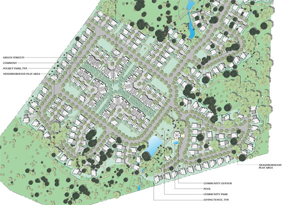 Partial site plan shown. The drawing above shows one of the produced sheets with the trees being shown as trees. Each of the units is a block with blocks for the cars allowing instant data retrieval for calculating parking amounts required for the site. 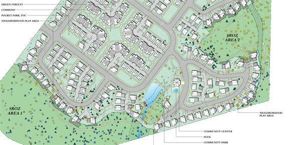 This drawing while similar to the above drawing uses an advanced block library, layouts and layers in the latest version of AutoCAD to swap out the trees in the first drawing with tree symbols representing size, type and criticalness of maintaining so that changes done in the drawing are instantly reflected in both sheets and can then be instantly plotted without additional modifications to either drawing. Every tree shown had been located on site, counted, numbered, sized, etc. For the entire site there were several thousand trees to account for.
2d site plan detailing large build outs of a ski resort which totals several thousand acres of site design. Located in the NW of the US, this project will exand an existing ski resort by several hundred acres. This project required assimilating very large DWG files from numerous sources including civil, the owners of the resort, and elsewhere and incorporation of existing trees, ski runs, contours and road data to conform to the design challenges presented by the architect generating the site layout. From numerous files, a single workable drawing was produced which in turn generated over 10 distinct drawings showing various areas at varying scales as well as diffent usesages; trial map drawing, proposed road drawing, proposed facility drawings, etc. thereby maximizing the return on the digital data contained within the drawing. 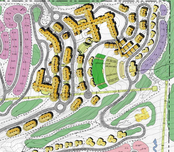 This is a small snippet of the entire drawing showing an example view of the overall layout of one section of expansion.
2d rendered site plan encorporating two larger congregate care retirement buildings as well as various senior living cottages which include duplexes and fourplexes. This project started with a civil 3d drawing from the local government agency of the entire vicinity, an aerial photograph and a hand sketch from the architectural design firm. After combining these very differnt types of data, a digital version was created and a sort of electronic felt marker was used to colorize the drawing showing off the roads, buildings and landscaping elements. 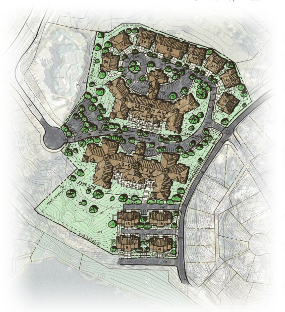 2d schematic site plan. 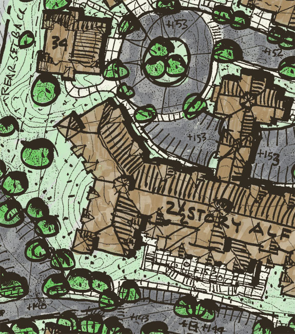 An enlarged blow-up of the site plan showing the digital felt pen effects used.
| ||