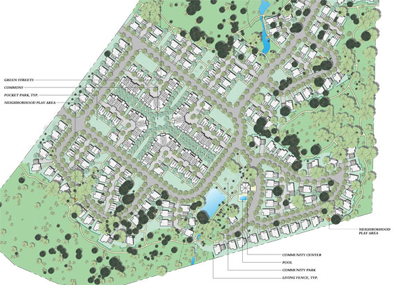
2d schematic site plan.
Partial site plan shown.
The drawing above shows one of the produced sheets with the trees being shown as trees. Each of the units is a block with blocks for the cars allowing instant data retrieval for calculating parking amounts required for the site.
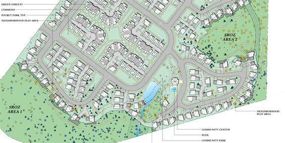
2d schematic site plan.
Partial site plan shown.
This drawing while similar to the above drawing uses an advanced block library, layouts and layers in the latest version of AutoCAD to swap out the trees in the first drawing with tree symbols representing size, type and criticalness of maintaining so that changes done in the drawing are instantly reflected in both sheets and can then be instantly plotted without additional modifications to either drawing. Every tree shown had been located on site, counted, numbered, sized, etc. and for the entire site there were several thousand trees to account for.